

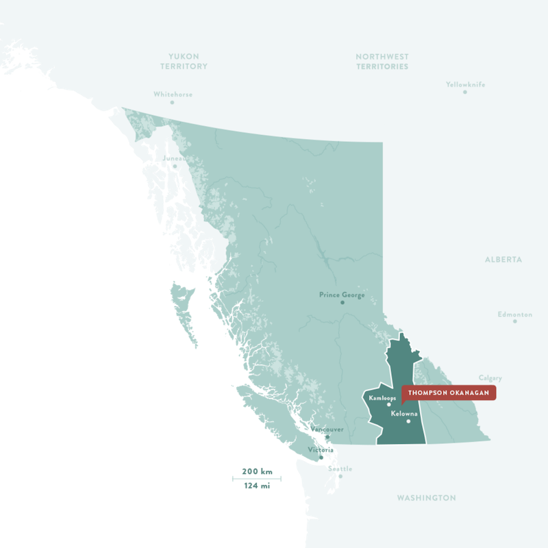
The Thompson Okanagan Tourism Association regional brand name “Thompson Okanagan” represents a geographic area nestled in the Southern Interior of British Columbia, Canada, named for two major geographic features: the Thompson River and Okanagan Lake.
The Thompson Okanagan region is a diverse area covering approximately 71, 600 km² / 27,644 mi², roughly the same size as Ireland. The landscape is varied, from the tallest peak in the Canadian Rockies to the semi-arid climate of the Okanagan Desert.
This diverse area with 9 sub-regions is home to over 120 communities, including 33 Indigenous communities. To the north lies Valemount and Mount Robson, with Osoyoos and Midway in the south, Cache Creek and Princeton to the west, and Christina Lake and the Shuswap to the east.
The Thompson Okanagan is rich in Indigenous culture, with sun-soaked valleys surrounded by sweeping grasslands and connected throughout by water.
Land Acknowledgement
TOTA acknowledges that the Thompson Okanagan region lies on the unceded, ancestral, and traditional territory of the Syilx, Secwépemc, and Nlaka'pamux Nations, who have inhabited these lands for over 10,000 years.
Commitment to Sustainable Tourism
We are so proud to share with the world this beautiful place we call home. However, the impact of tourism on the environment and social systems can be significant. The Thompson Okanagan region is committed to working consciously to protect the natural and cultural resources. We ask that our guests travel respectfully and responsibly so this region may be enjoyed by all who live and visit here for years to come.


Thompson Okanagan Sub Regions & Communities
The sub regions and communities are listed from north to south, and east to west. Links to destination marketing websites are included where applicable.
Thompson Valley (North / South)
Okanagan Valley (North / Central / South)

Thompson Valley
Avola, Birch Island, Blackpool, Blue River, Clearwater, McMurphy, Valemount, Vavenby, and Wells Gray Provincial Park.
Lower North Thompson Valley
Barriere, Chu Chua, Darfield, Little Fort, Louis Creek, McLure, and Vinsulla.
South Thompson Valley
Heffley Creek, Kamloops, Knutsford, Lac Le Jeune, Monte Creek, Monte Lake, Pinantan Lake, Pritchard, Tranquille, Sun Peaks, and Westwold.
Anchored by the North Thompson River, the North Thompson Valley provides access to pristine wilderness, remote fish camps, and four-season resorts. It is also home to Mount Robson, the highest peak in the Canadian Rockies, and Wells Gray Provincial Park, home of Helmcken Falls and over 40 other waterfalls.
The South Thompson features volcanic land masses that form the plateau country northwest of Kamloops, while forests and lakes fill the lowlands. This geological history is preserved in the McAbee Fossil Beds. Ancient rivers carved the landscape, forming the modern valleys of the Thompson River and ice age glaciers scoured the valleys and rounded the plateaus and mountains. Kamloops anchors the region with its urban amenities and Indigenous culture, while top rated golf courses, wineries, and mountain resort activities are minutes away.
Ashcroft, Aspen Grove, Brookmere, Cache Creek, Clinton, Douglas Lake, Historic Hat Creek, Logan Lake, Lower Nicola, Lytton, Merritt, Quilchena, Savona, Spences Bridge, Tunkwa Lake, Upper Nicola, and Walhachin.
Gold Country’s diverse landscapes, with over 20 provincial parks and protected areas, range from semi-arid desert to thick forests with lakes, grasslands, meadows, river canyons and mountains. The region offers a unique way to explore these natural features through geocaching. Cowboy lore and pioneer spirit, Indigenous heritage and welcoming communities share a landscape of surreal and arresting beauty.


Anglemont, Balmoral, Blind Bay, Canoe, Celista, Chase, Craigellachie, Deep Creek, Eagle Bay, Eagle Valley, Enderby, Falkland, Gardom Lake, Gleneden, Lee Creek, Magna Bay, Malakwa, Notch Hill, Ranchero, Saint Ives, Salmon Arm, Scotch Creek, Seymour Arm, Sicamous, Silver Creek, Skimikin, Sorrento, Sunnybrae, Tappen, Three Valley Gap, White Lake, and Wild Rose Bay.
The Shuswap is a region of friendly communities with lots of culture, linked by an amazing lake and surrounded by beautiful forested mountains. Friendly folks welcome visitors to studios, galleries, lively museums, free concerts and internationally renowned musical events. Meet a winemaker and sip a local vintage at a winery, meet a farmer and tuck into apple pie, or chat it up with shopkeepers in surprising little boutiques.
The Shuswap Lake system encompasses over 1,000 km (620 mi) of shoreline. The region hosts the largest houseboat fleet in Canada and the famous Adams River Salmon Run. In addition to the lakes, rivers, and beaches, the terrain consists of flat inland valleys, rolling hills and forests set against the backdrop of the Monashee Mountains.
Okanagan Valley (North / Central / South)
North Okanagan
Armstrong, Cherryville, Coldstream, Creighton Valley, Grindrod, Killiney Beach, Lavington, Lumby, Mabel Lake, Spallumcheen, and Vernon.
Central Okanagan
Kelowna, Lake Country, Peachland, West Kelowna, and Westbank.
South Okanagan
Gallagher Lake, Kaleden, Marron Valley, Naramata, Okanagan Falls, Oliver, Osoyoos, Penticton, and Summerland.
The fruit and wine producing Okanagan Valley stretches 200 km (124 mi) south from the Shuswap Lake region to the US border. Okanagan Lake at 135 km (83 mi) anchors the region with an abundance of recreational opportunities. Wineries, beaches, golf, and winter sports complement the urban energy and cultural amenities of Kelowna, the vibrant economic hub of the Okanagan Valley. The Thompson Okanagan’s only international airport is located in Kelowna, providing easy access throughout the corridor.
The South Okanagan is renowned for having the warmest weather conditions in all of Canada. With over 2,100 hours of annual sunshine, the climate is comfortable all year round.


Allenby, Cawston, Chopaka, Coalmont, Copper Mountain, Hedley, Keremeos, Olalla, Princeton, and Tulameen.
The Similkameen River brings life to the arid grasslands of the valley. Keremeos is the Fruit Stand Capital of Canada and centre of B.C.’s newest wine region. Cawston is the Organic Capital of Canada. The Similkameen Valley is rich in mining history, First Nations culture and agricultural lands where colourful fruit stands are being joined by a host of small wineries. First Nations began mining the mountainsides in antiquity and the mining tradition is remembered in Hedley. The Similkameen boasts scores of accessible fishing lakes along with the remote backcountry terrain of Cathedral Lakes Provincial Park.
Beaverdell, Big White, Boundary Falls, Bridesville, Carmi, Carson, Cascade, Christina Lake, Eholt, Grand Forks, Greenwood, Kettle Valley, Midway, Rock Creek, and Westbridge in the Christian Valley.
This southern stretch of country encompasses a section of the Kettle River Valley on the Canada-US border where historic sites and natural beauty compete for attention. Boundary Country remains true to its heritage with some of the best-preserved period architecture in B.C. Communities reflect their origins in mining, railway building and agriculture. Former rail lines invite hiking and biking while lakes, rivers, forested highlands and easy access to Baldy Mountain Ski Area provide opportunities for more outdoor recreation.
